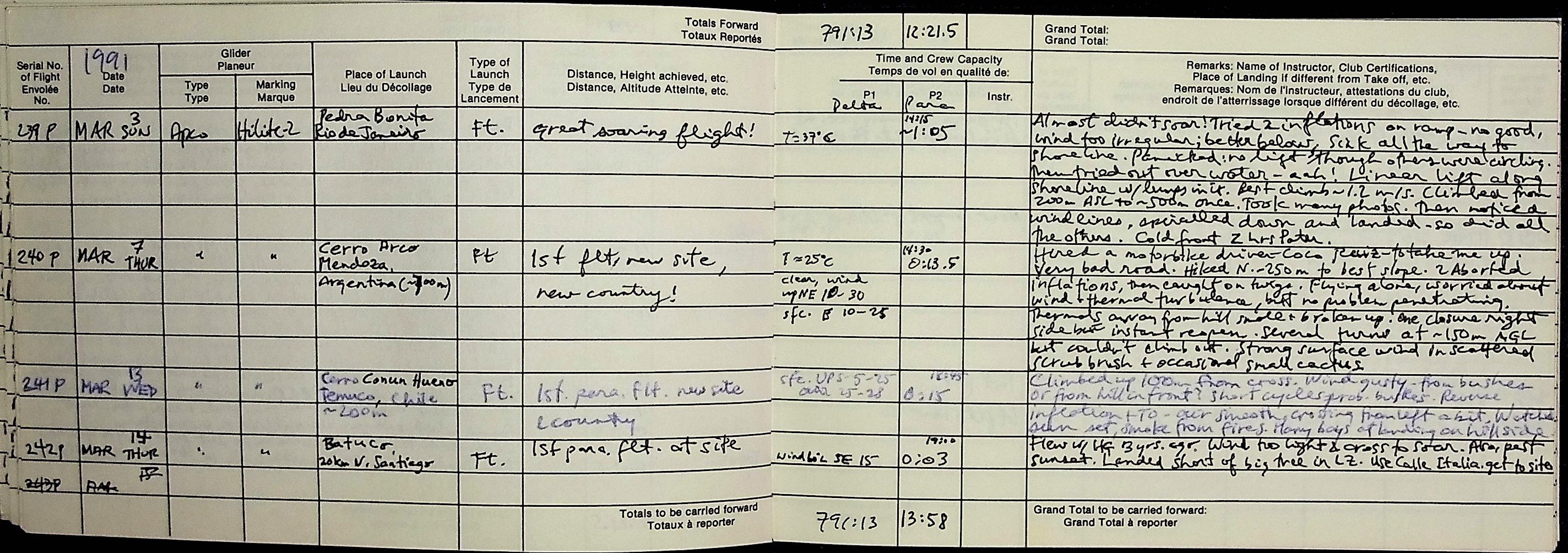
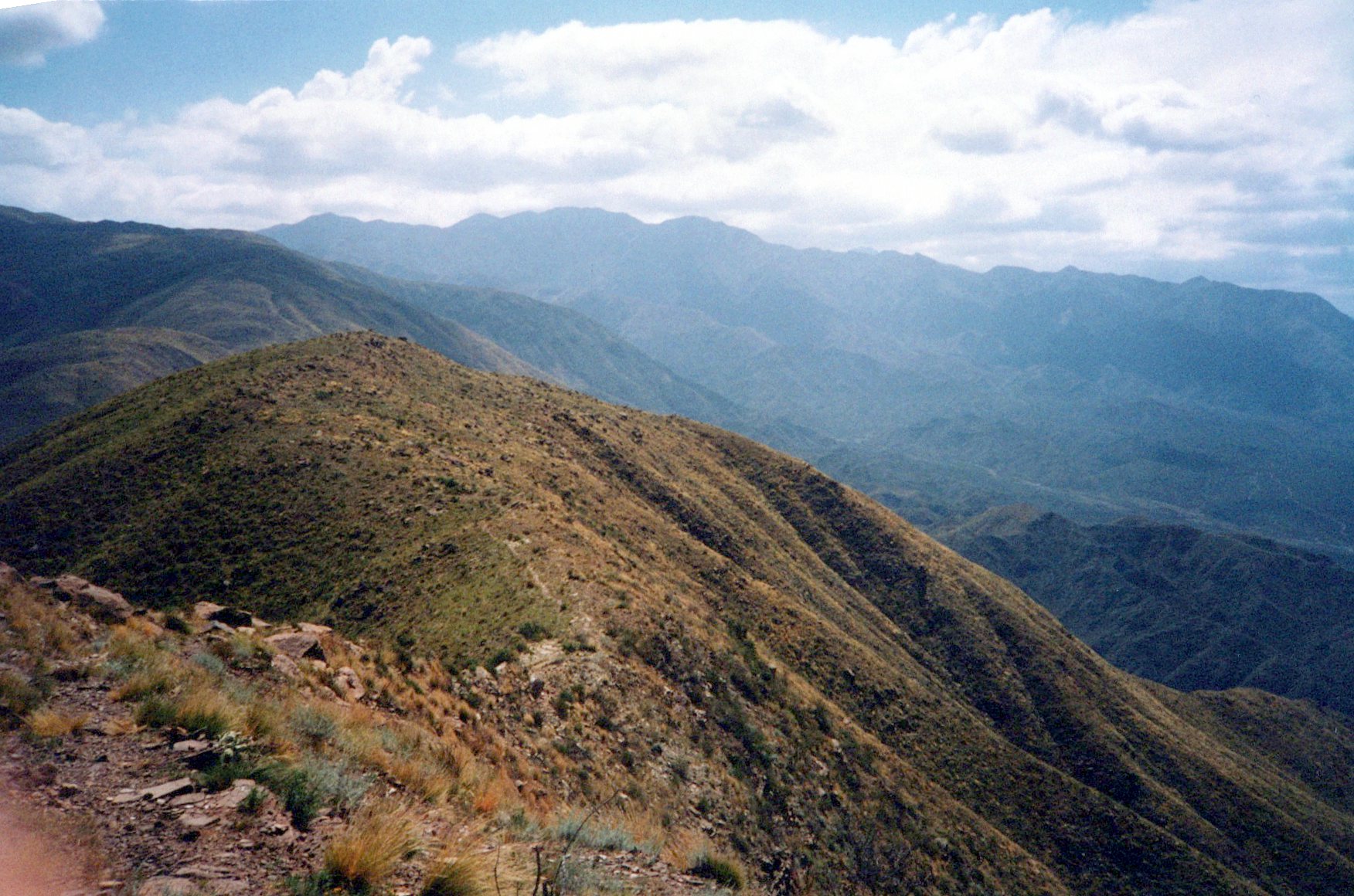
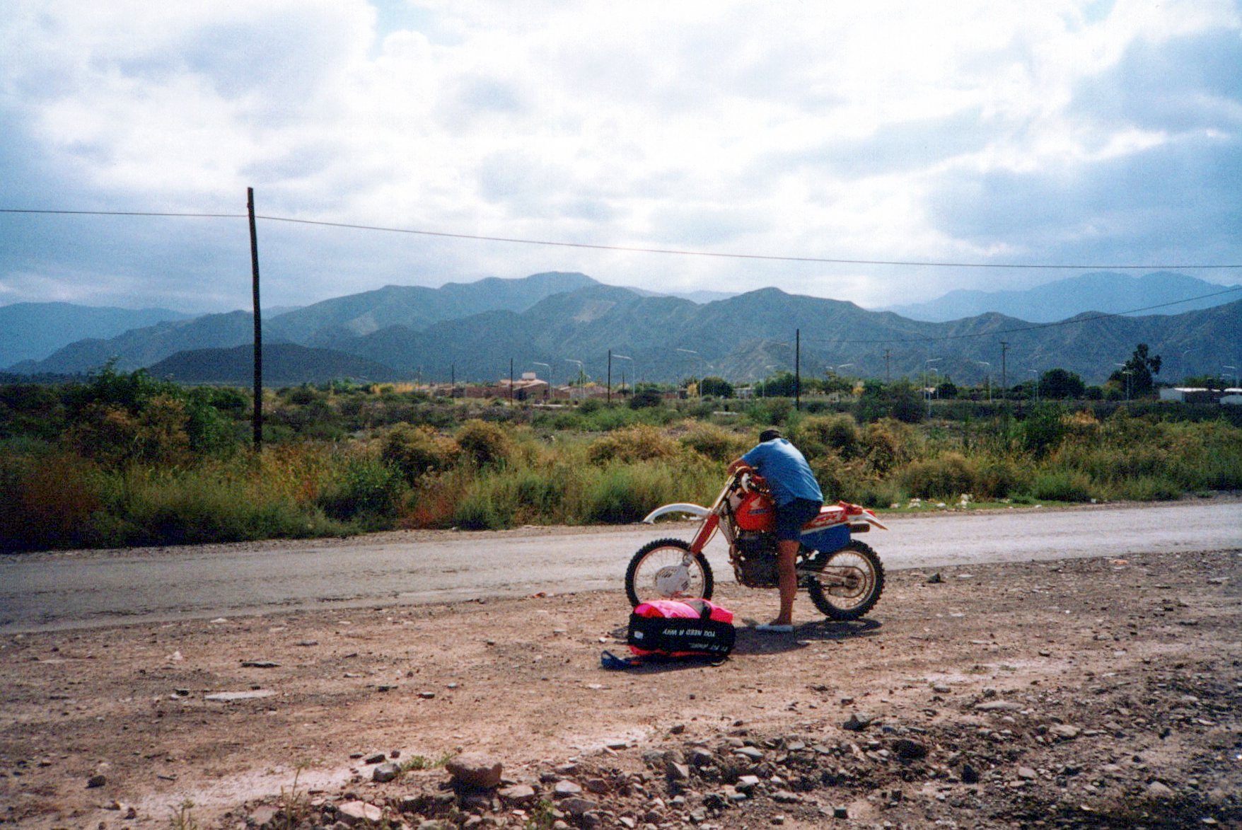
On my ABC (Argentina, Brazil, Chile) trip in 1991 – my first visit to Argentina or Brazil – I stopped with my wife Catherine in Mendoza, Argentina. This city at the edge of the western Pampas, at the foot of the Andes, and thanks to irrigation and fertile soil is the heart of the countries wine-growing district. Naturally, we did sample the local product, but also I wanted to sample the local flying conditions by making my way to the top of the hill overlooking the town.
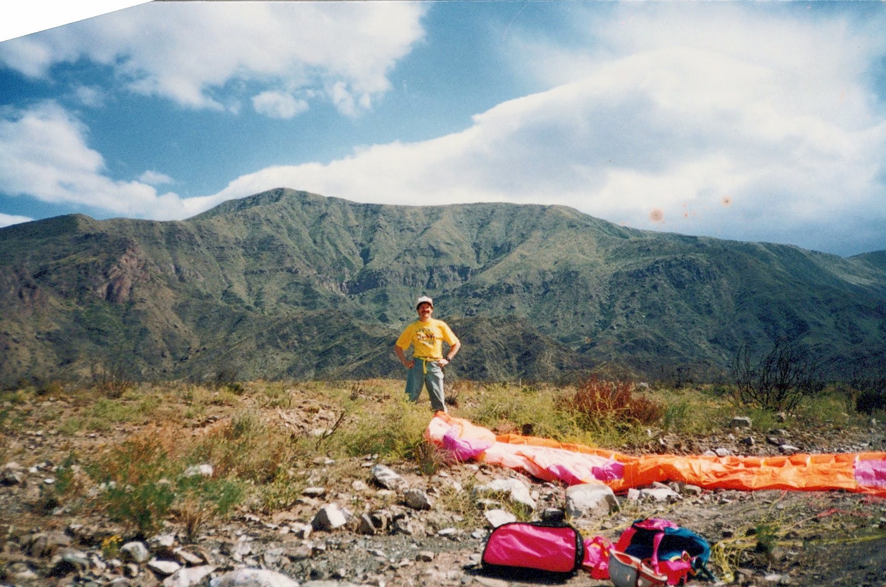
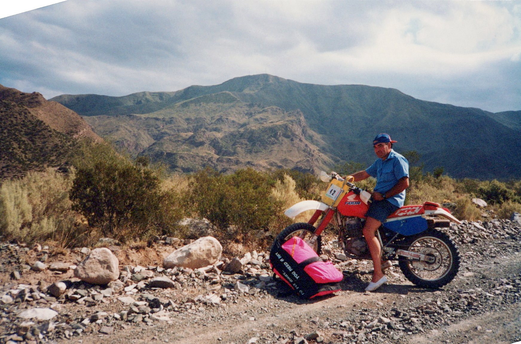
On recommendation of a local hang glider pilot that I had met years earlier in Venezuela, Tato Vargas, I went to a local motorcycle shop and hired the owner Coco Ruiz to take me up the hill on his motorbike, with my paraglider on my back. Good thing we used a dirt-bike, and not a car, because the route up was fairly rough. But he did get me to the summit where there was a wind streamer showing me a light but gusty uphill breeze. Trying to launch in the lulls, I aborted my first two attempts, but got away on the third try around 14:30 after untangling lines that got caught in bushes.
Being on my own as a pilot, and never having flown near the Andes, I was vigilant in assessing possible risks. I flew along the ridge, not finding much left as I headed off the north end of it towards a dry river bed where I planned to land. I then found a bit of an updraft which I started to circle in, but soon got scared off by a bit of turbulence. Not only that, but I did not know what kind of atmospheric dragons lurked in these mountains, and I didn’t want to find out. So I left that area and soon landed down below, where there was quite a strong wind blowing up toward the mountain. But I was not disappointed, as it was mission accomplished: my very first flight in Argentina! 13.5 minutes for the logbook. That may not seem like much of an accomplishment, but at the time I only had One full year of flying experience with paragliders, and was still leery of them. I went on to fly them for another 20 years.
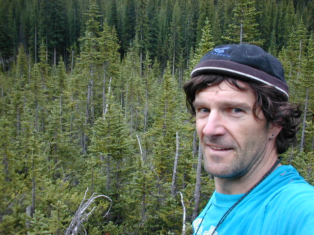
happy pilot after landingCoco Ruiz & his dirt-bikeLaunch spot was near towerLooking north from takeoff spotCerro Arco above the motorbike
Does anyone remember Google Buzz? It was the corporation’s first attempt at an all-encompassing social media tool to combat the growing threat from Facebook. it had lots of good features, but sadly did not achieve sufficient traction to stop the relentless growth of Facebook. In any event, for a while i posted frequently using that tool, until they closed the doors that is. At that point, I was offered the opportunity to download all of my posts, and so I did. I kept a copy as a PDF, and here it is (all 61 pages of posts are in the PDF file below). If you copy and paste the links into your browser address bar, you can still see all of my links.
I visited the confluence of 51˚N and 117˚W twenty years ago, on August 09, 2002, with my 11-year-old son Andrew supporting me. It was our second attempt, following an initial reconnaissance four days earlier. On that earlier outing, we wanted to get a visual impression of how hard it might be to bushwhack up about 10 km of Rockies forest in the narrow Malachite Creek valley. However, moments before turning around on the Bobby Burns logging road 40 km W of Parson, BC, we discovered a brand-new road heading up into the valley! Our excitement mounted as, with the GPS turned on, Andrew began to count down the final kilometres: 10 – 9 – 8 -7 – 6 – 5 – 4… and then the road ended, 3.6 km from the confluence. Solid forest lay ahead, it was 15:30 and a storm was approaching. And we needed to be 200 km away in the Rogers Pass by night-fall. We backed off and vowed to return.
Four days later we were back, with just three hours to spend on the effort. It was again 15:30, and I needed to be in Invermere by about 19:00. Andrew agreed to stay in the car while I explored up the valley, reasoning that I could move more quickly alone. I would spend an hour hiking in, an hour to hike out, and we’d have an hour to make our drive out. Perfect!
At first, I made good going in the forest, hindered only slightly by considerable deadfall. Even better, I soon found a narrow, rough trail that showed signs of a saw having being used on problem logs. After a half hour, I had a good view up-valley, and had broken out onto a wide, meandering stream up whose sandbars I could actually run in order to make better progress. After 45 minutes, I had little more than a kilometre to go. And then, the bearing line took me across the river, up a steep forested N-facing hillside…
An arduous and frustrating hour ensued, as I crossed several overgrown avalanches paths, fields of enormous boulders, several hillside torrents, and passed several piles of bear scat, some of which were still wet (but not, thankfully, warm). I was very conscious of being alone in the woods.
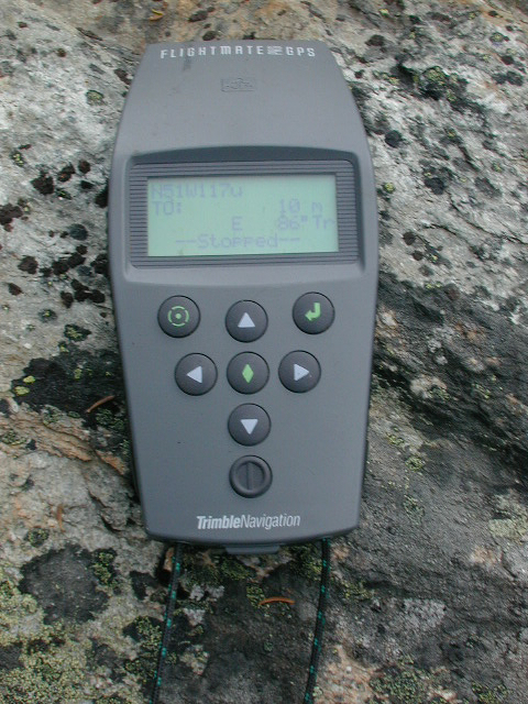
Finally, I forded the river a last time, having long since abandoned any attempts to keep my feet dry, and entered one more rapidly overgrowing avalanche slope. The last 50 m took 15 minutes, as I headed first in one direction, then another – the GPS couldn’t get a fix on my bearing, because I could not walk in a straight line for the 3 seconds it would take to figure out my speed and bearing. Finally, I approached a large boulder and the “distance to goal” indicator briefly read “0 m”! After I put my old Trimble Flightmate Pro on the rock, it began to “wander” from 0 m to 16 m, reaching 10 m from the confluence when I snapped the picture of its screen (picture 5).
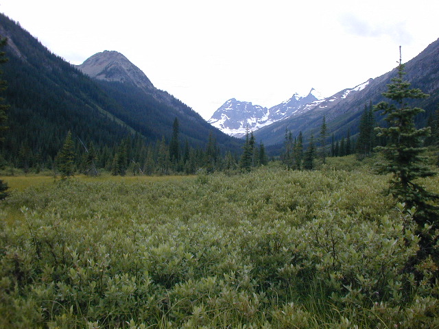
To record the location, I shinnied up a nearby tree and hung some red flagging with the confluence.org website URL and the date, and took some pictures. Picture 1 is looking downstream from the site, while Picture 2 looks to the W, toward the Great Divide. In Picture 3, I snapped a self-portrait, looking all the world like an escaped convict: hot, sweaty and pestered by mosquitos evident on my forehead. Picture 4 shows the approach across one of the swamps: the confluence lies around the corner to the L about 2 km in the distance.
With the mosquitos beginning to eat me alive, sweating profusely after drinking little and eating nothing on the way in, I realised I had now spent 1:45 on the inbound trip, and still needed to return to the car. I rushed back as quickly as possible, taking a high line along dark N-facing hillsides that avoided much of the earlier bushwhacking (which my now lacerated lower legs thanked me for), and ran along as much of the riverbed as possible. It still took 1:30 to get back to my car.
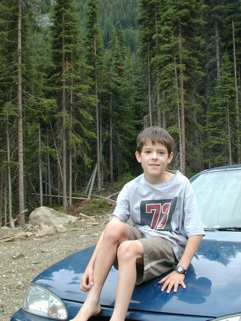
I had imagined my young son to be in a panic, by himself in the woods, but he was relaxed, having played cards and having read a book. He calmly explained that he had fully expected me to take 2 hours to go in and 2 to come out! So we celebrated our success with a snack and I snapped a pic of him (picture 6) before we headed off.
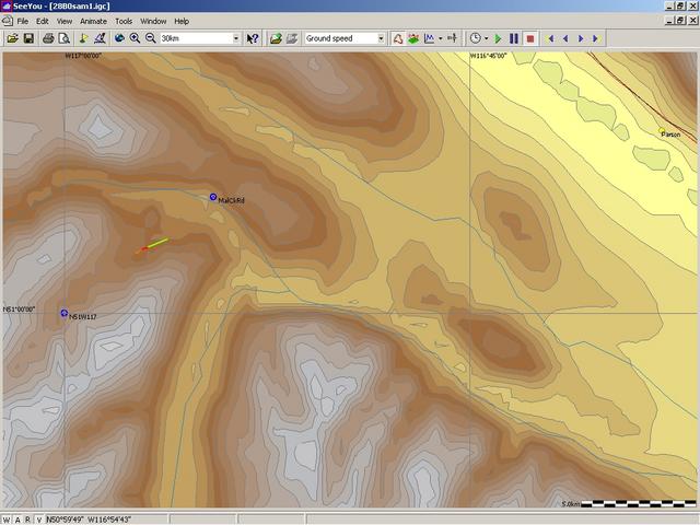
To anyone wanted to visit this confluence, your best bet might be to come back in 2003, when, it appears, the logging company may have pushed the road further up the narrow valley. Picture 7 is a screen print from my mapping program, (SeeYou), with the confluence marked as a waypoint, and a partial track log from my backup Garmin GPS38 superimposed on the map. The old 38 managed to record only a minute of our drive away from the road-end before its batteries gave out.
Definitely a lot more work than I had intended or hoped, but also a lot of fun and adventure was had navigating to a mysterious point hidden deep in the backwoods of the Canadian Rockies! And Andrew was glad it was all over, too.
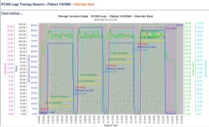
Here is a flashback to mid September, 2014 when I recorded my strongest sprint session. My power output was 66 W average over 20 minutes. Two of my four sprints were at about 80 W average power, and the work output was 290 met minutes.
By comparison, one of my worst sprint sessions recently was in mid February 2016, when my power output was only 22 W average over 20 minutes. My first sprint was at 55 W average power, but it fell to less than half of that subsequently. The work output was only 100 Met minutes.
Moral of the story? Don’t get discouraged when you have a slump. Though I haven’t yet surpassed my original record, I have recovered significantly from this past winter’s slump, and now average about 45 W in a 20 minute sprint session.
This article was written by someone with cerebral palsy (which is a form of spinal cord injury suffered during birth), but it can be appreciated by and apply to anyone with any type of disability or spinal cord injury.
Just before the end of 2015, on December 28 in fact, I reached a new benchmark and the goal I was aiming to achieve by the end of the year: 10,000 km ridden on my FES bike in 3 1/2 years (4200 km in 2015 alone). that’s a lot of distance covered by a pair of paralyzed legs! If you are able-bodied, how far did you cycle last year?
Here is a copy of the summary page of the online log of all of my rides, as recorded by the bike manufacturer. In addition to the total distance ridden so far (6329 miles as of January 15, 2016 = 10,185 km), you can also see the distance I covered in each session (in red, and by others with my same physical condition in blue), and the average power output during each session. I appear to be working much harder than others in my situation. I have no explanation for this other than that I love cycling!
I also manually log all of my rides on Strava, and you can see my profile and stats there.